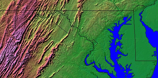
Above is an image of Greater Washington and surrounding region. The Chesapeake Bay is on our right (east), with the Atlantic Ocean another 50 miles away. The Appalachian mountains are on our left (west), with the Shenandoah range closest to us.
Flowing from the upper left to the lower right, into the Bay, is the Potomac. It defines the border between Maryland and Virginia, flowing from the mountains, through the diamond-shaped District of Columbia.
It's where the Piedmont Plateau narrows enough for the the mountains, the bay, and the coastal plain to come into one view.